Question: Can you find a platform that uses satellite imagery to monitor and track environmental pollution?
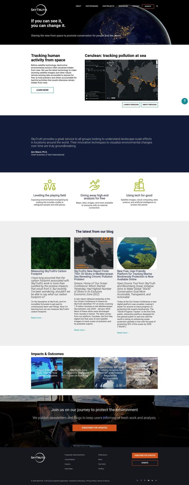
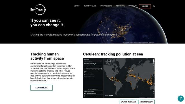
SkyTruth screenshot thumbnail

SkyTruth

For monitoring and tracking environmental pollution with satellite imagery, SkyTruth is a good option. It uses satellite imagery and remote sensing data to aid conservation and accountability efforts. SkyTruth offers free access to satellite imagery and advanced monitoring tools, like Cerulean for monitoring ocean pollution and SkyTruth Alerts for mapping and monitoring changes. Through government satellites and private partnerships, it offers advanced analysis tools for free to promote conservation and accountability.
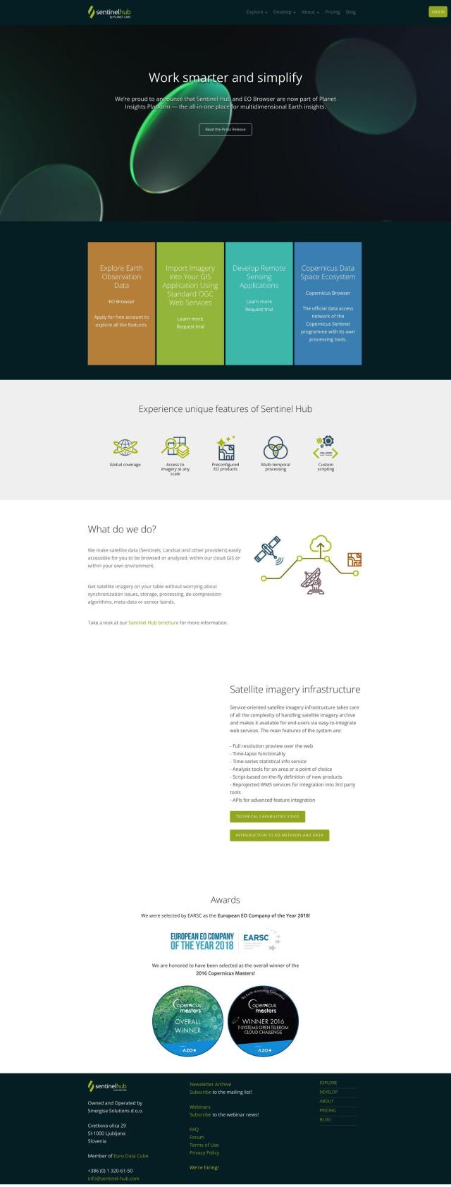
Sentinel Hub screenshot thumbnail

Sentinel Hub

Another good option is Sentinel Hub. This cloud-based API makes it easier to access satellite imagery from sources like Sentinels and Landsat, and it can be easily integrated into other remote sensing projects. It includes tools like EO Browser for exploring and comparing high-resolution imagery, and custom visualizations. Sentinel Hub handles the grunt work of data processing and storage so you can concentrate on analysis and applications, and there's a free tier for non-commercial use.

Nearmap screenshot thumbnail

Nearmap

Nearmap is a full-featured location intelligence platform that includes AI predictions and geospatial tools. It offers high-resolution imagery, 3D modeling, and near-infrared imagery for environmental monitoring. Nearmap is used in urban planning, emergency services and environmental impact assessments, helping businesses and governments make more informed decisions.
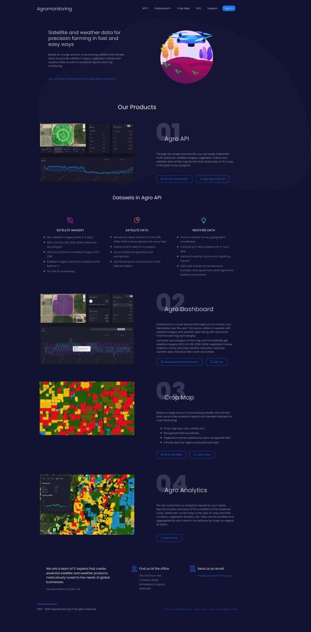
EOSDA screenshot thumbnail

EOSDA

Last, EOSDA offers geospatial data analytics using satellite imagery and machine learning algorithms. It helps businesses in agriculture and forestry with crop monitoring, yield forecasting and forest monitoring. EOSDA's tools, like LandViewer for storing and processing satellite imagery, can provide insights that can help improve sustainability and decision-making in these areas.

Additional AI Projects

FlyPix screenshot thumbnail

FlyPix

Detect, localize, track, and monitor objects across industries with advanced AI models, generating actionable, geo-referenced insights from complex imagery.

Airly screenshot thumbnail

Airly

Provides real-time hyperlocal air quality data, empowering governments and businesses to make data-driven decisions to decrease emissions and protect citizens' health.

Esri screenshot thumbnail

Esri

Uncover hidden patterns and drive predictive modeling with spatial analytics and machine learning, combining location-based data for innovative insights.

Earth Engine Apps screenshot thumbnail

Earth Engine Apps

Interactive, publicly accessible apps for Earth Engine analysis, enabling non-experts to easily explore and visualize Earth observation data and tools.

Skydio screenshot thumbnail

Skydio

Capture detailed data in challenging environments with AI-powered autonomous drones, featuring ultra-high resolution cameras and obstacle avoidance.

Agromonitoring screenshot thumbnail

Agromonitoring

Provides precision farming insights through satellite imagery, vegetation indices, and weather data, empowering data-driven crop management and decision-making.

DroneDeploy screenshot thumbnail

DroneDeploy

Combines data from multiple sources, including drones and cameras, into one platform, automating capture and extracting insights with AI for informed decision-making.

PIX4D screenshot thumbnail

PIX4D

Converts images into accurate maps and 3D models for analysis, inspections, and measurements, with survey-grade accuracy and georeferencing.

ePlant screenshot thumbnail

ePlant

Remotely monitor tree health and environmental conditions with long-range wireless sensors, tracking growth, stress, and weather patterns for data-driven decisions.

Weatherstem screenshot thumbnail

Weatherstem

Provides real-time weather monitoring and alert systems, offering customizable features like lightning strike tracking, WBGT alerts, and radar updates for enhanced safety and performance.

CARTO screenshot thumbnail

CARTO

Analyze and visualize spatial data at any scale with native cloud integration, intuitive drag-and-drop interface, and built-in GenAI capabilities.

Meteomatics screenshot thumbnail

Meteomatics

Access global high-resolution weather, ocean, environment, and climate data through a comprehensive API, including historical, real-time, and forecast data up to 2100.

Atmo screenshot thumbnail

Atmo

Produces high-resolution, real-time weather forecasts with up to 50% greater accuracy and 40,000 times faster processing than traditional models.

VelocityEHS screenshot thumbnail

VelocityEHS

Leverage AI-powered predictive capabilities to anticipate EHS & ESG problems, prevent errors, and protect the bottom line with global visibility and expert guidance.

Pl@ntNet screenshot thumbnail

Pl@ntNet

Identify plants from photos using image recognition technology, and contribute to biodiversity research by reporting observations and exploring species near your location.

Ecolink screenshot thumbnail

Ecolink

Generates immersive sustainability labels with AI-powered product data, GPS coordinates, and storytelling, empowering eco-friendly purchasing and customer loyalty.

Airdata screenshot thumbnail

Airdata

Unlock 360-degree views of flights, track maintenance, and create custom reports to optimize drone operations and ensure safer, more reliable flights.

AI Clearing screenshot thumbnail

AI Clearing

Generates 3D site reports with 100% site coverage, providing accurate and efficient progress monitoring, reducing re-work costs and litigation risks.

Data Commons screenshot thumbnail

Data Commons

Aggregates and makes accessible 240 billion data points from 193 countries, providing graphical exploration and download tools for complex data analysis.

OxBlue screenshot thumbnail

OxBlue

Process project photos to monitor activity, safety, and weather data, enabling informed decision-making with real-time visual insights.