Agromonitoring is a service that offers satellite and weather data for precision farming. It provides a suite of tools to support agriculture by providing satellite imagery, vegetation indices, and weather data to help monitor and manage crops.
The service includes a number of products to meet different agricultural needs:
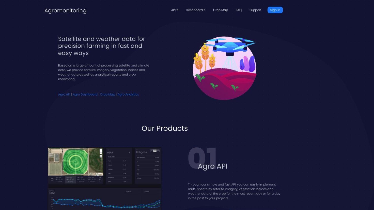
- Agro API: A lightweight and fast API that allows customers to integrate satellite imagery and weather data into their own projects. The API offers multi-spectrum satellite imagery, vegetation indices such as NDVI, EVI, EVI2, DSWI, and NDWI, as well as historical data from 2018. Customers can also retrieve weather data, including current conditions, forecasts, and historical archives.
- Agro Dashboard: A visual service that allows customers to monitor their fields over the course of a year. The dashboard offers satellite imagery and weather data, as well as advanced machine learning technology. Customers can draw polygons on the map to get immediate satellite imagery, vegetation indices, and weather forecasts for specific fields.
- Crop Map: Offers analytical reports and detailed datasets for crop monitoring, including crop types, field boundaries, and vegetation indices. Customers can get data on recognized field boundaries, vegetation statistics for each field, and climate data for specific areas.
- Agro Analytics: Customizable analytical reports that offer detailed insights into crop conditions, distribution maps, and vegetation statistics. Reports can be stratified and aggregated by different criteria such as crops, regions, or years.
Agromonitoring supports precision farming with features like:
- Satellite Imagery: New imagery every 2-4 days, with historical archives from 2018
- Vegetation Indices: NDVI, EVI, EVI2, NRI, DSWI, and NDWI for any polygon
- Weather Data: Current conditions, 5-day forecasts with 3-hour steps, and historical archives
- Soil Data: Temperature, moisture, and other soil parameters
Pricing is tiered, with different levels of access and usage:
- Free: £0, 1,000 ha of total polygons, 60 API calls per minute to satellite data
- Starter: £20, 4,000 ha of total polygons, 600 API calls per minute to satellite data
- Small Kit: £200, 20,000 ha of total polygons, 3,000 API calls per minute to satellite data
- Corporate: Custom pricing for larger usage
The service is geared for farmers, agricultural developers and companies that need detailed insights into crop management and weather information. By combining machine learning with advanced satellite technology, Agromonitoring offers actionable data to support decision-making in the agricultural industry.
Published on June 30, 2024
Related Questions
Tool Suggestions
Analyzing Agromonitoring...