Question: Is there a technology that offers near-infrared imagery for environmental monitoring and urban planning?

Nearmap screenshot thumbnail

Nearmap

For environmental monitoring and urban planning that includes near-infrared imagery, Nearmap is a powerful choice. The location intelligence platform offers high-resolution aerial imagery, 3D modeling, and AI-generated data sets. It also offers near-infrared imagery for environmental monitoring, and it's a good choice for urban planning, infrastructure and real estate projects.

Esri screenshot thumbnail

Esri

Another option is Esri, which offers a broad range of GIS mapping software with spatial analytics. Esri offers 3D visualization, location intelligence and remote sensing. It's good for real-time decision making and predictive modeling, and it's used in many fields, including infrastructure planning and climate work.

EOSDA screenshot thumbnail

EOSDA

If you're looking at agriculture and forestry, EOSDA offers a geospatial data analytics platform that combines satellite imagery and machine learning. It offers tools for crop monitoring, yield forecasting and carbon modeling. EOSDA's high-resolution satellite imagery can be used for detailed assessments of land use, so it's a good choice for environmental monitoring and sustainable decision-making in agriculture and forestry.
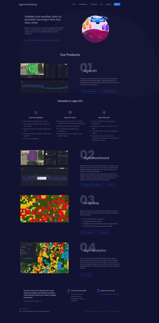
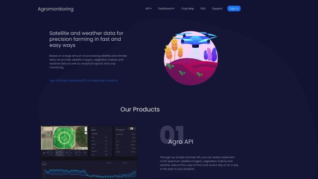
Agromonitoring screenshot thumbnail

Agromonitoring

Also worth a look is Agromonitoring, which offers precision farming services based on satellite and weather data. It offers tools like Agro API, Agro Dashboard and Crop Map for monitoring and analyzing crop conditions. It's a good choice for farmers, agricultural developers and companies that want to improve crop management and make data-driven decisions.

Additional AI Projects

CARTO screenshot thumbnail

CARTO

Analyze and visualize spatial data at any scale with native cloud integration, intuitive drag-and-drop interface, and built-in GenAI capabilities.

ePlant screenshot thumbnail

ePlant

Remotely monitor tree health and environmental conditions with long-range wireless sensors, tracking growth, stress, and weather patterns for data-driven decisions.

Hexagon screenshot thumbnail

Hexagon

Combines sensor, software, and autonomous technologies to increase efficiency, reduce waste, and improve sustainability across industries through data-driven digital reality solutions.

INRIX screenshot thumbnail

INRIX

Harnesses 50 petabytes of transportation data to provide real-time traffic insights, crash alerts, and parking analytics, optimizing urban mobility and road safety.

Mapbox screenshot thumbnail

Mapbox

Create customizable, interactive maps with live-updating data and advanced navigation features for web, mobile, automotive, and AR applications.

Matterport screenshot thumbnail

Matterport

Capture and collaborate on 3D digital twins of real-world sites, leveraging AI-driven analytics and immersive virtual experiences for improved project outcomes.

MapmyIndia screenshot thumbnail

MapmyIndia

Seamlessly navigate and optimize last-mile operations with integrated navigation, route planning, and location intelligence solutions powered by India's best maps.

Tomorrow.io screenshot thumbnail

Tomorrow.io

Combines global spacecraft data, AI/ML models, and advanced forecasting to provide hyper-accurate weather information for any location, enabling proactive decision-making and resilience.

Unearth Insights screenshot thumbnail

Unearth Insights

Access a unified suite of location data and analytics tools, powered by an AI co-pilot, to uncover insights and drive business decisions faster.

Spatial.ai screenshot thumbnail

Spatial.ai

Unlock deeper customer insights with behavioral segmentation tools, profiling social, mobile, and web behavior to inform targeted marketing and location strategies.

Placekey screenshot thumbnail

Placekey

Assigns a unique identifier to any physical location, standardizing address information for easy data sharing and integration across organizations.

Rapid Editor screenshot thumbnail

Rapid Editor

Automates map creation and updates using machine learning and satellite imagery, reducing manual effort and increasing accuracy.

Radar screenshot thumbnail

Radar

Radar combines geofencing, geocoding, and mapping for accurate, cost-effective location-based experiences.

AI Clearing screenshot thumbnail

AI Clearing

Generates 3D site reports with 100% site coverage, providing accurate and efficient progress monitoring, reducing re-work costs and litigation risks.

CarbonReach screenshot thumbnail

CarbonReach

Combines device, location, network, and behavior data to predict future risks, providing a comprehensive view of network activity for targeted security action.

Geotab screenshot thumbnail

Geotab

Leverage AI-driven insights and recommendations to optimize fleet operations, improve safety, and reduce emissions, while automating compliance and increasing productivity.

Electricity Maps screenshot thumbnail

Electricity Maps

Access real-time, historical, and forecasted carbon intensity data for 230+ regions to inform energy decisions and reduce carbon footprint.

OpenSearch screenshot thumbnail

OpenSearch

Build scalable, high-performance search solutions with out-of-the-box performance, machine learning integrations, and powerful analytics capabilities.

LandingLens screenshot thumbnail

LandingLens

Unlock insights from unlabeled images, achieve accurate results, and deploy computer vision models flexibly and scalably across industries.

Spotfire screenshot thumbnail

Spotfire

Integrate, prepare, analyze, and act on data from multiple sources with a single platform for real-time data exploration and point-and-click data science.