Question: Do you know of a solution that enables users to easily create custom maps and visualizations using Earth Engine data without requiring programming expertise?

Earth Engine Apps screenshot thumbnail

Earth Engine Apps

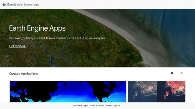
If you want to build custom maps and visualizations using Earth Engine data but don't have programming skills, Earth Engine Apps offers a collection of interactive user interfaces. This tool offers a variety of apps for different tasks, including the Ocean Timeseries Investigator, Linked Maps, Split Panel, Mosaic Editor and the Global Population Explorer. These apps help make Earth Engine data more accessible, offering a simple interface for exploring and interacting with many different data sets without having to be a programming guru.

CARTO screenshot thumbnail

CARTO

Another good choice is CARTO, a cloud-based location intelligence platform that makes it easier to analyze and visualize spatial data. CARTO has a drag-and-drop interface, more than 100 pre-built analysis modules and rich data visualization tools. It can handle large-scale app development and comes with access to more than 12,000 geospatial data sets, making it a good option for businesses that want to tap into spatial analytics and visualization for business decisions.

Esri screenshot thumbnail

Esri

If you're interested in GIS mapping and spatial analysis, Esri is a powerful option. Esri's technology includes a lot of tools, including 3D visualization, location intelligence and spatial analysis. It can be used in many industries and for many tasks, from retail site selection to infrastructure planning. Esri also offers a 21-day free trial and extensive developer tools, so it's a good option for spatial data needs.

Mapbox screenshot thumbnail

Mapbox

Last, Mapbox offers customizable maps and rich geospatial data through APIs and SDKs. It can be used to create interactive maps that update in real time, perform advanced routing and find precise locations. Mapbox is used by many companies for things like navigation and data analysis. It offers a free tier and flexible pricing plans depending on your needs.

Additional AI Projects

Textomap screenshot thumbnail

Textomap

Automatically extracts locations from text-based content to create interactive maps in seconds, saving time and effort.

Google Maps Platform screenshot thumbnail

Google Maps Platform

Unlock location-based insights and enhance user experiences with customizable, real-time maps, routes, and geospatial data for informed decision-making.

Geoapify screenshot thumbnail

Geoapify

Build location-based apps with ease using a suite of APIs for mapping, geocoding, route optimization, and spatial analytics, with flexible pricing and no data restrictions.

Rapid Editor screenshot thumbnail

Rapid Editor

Automates map creation and updates using machine learning and satellite imagery, reducing manual effort and increasing accuracy.

DataChat screenshot thumbnail

DataChat

Access complex data insights without coding, using a familiar chat and spreadsheet interface to generate transparent, reproducible results.

Nearmap screenshot thumbnail

Nearmap

Transforms high-resolution aerial imagery into actionable insights with AI predictions, 3D modeling, and geospatial tools for informed business decisions.

Streamlit screenshot thumbnail

Streamlit

Build interactive data apps with a few lines of code, and deploy instantly with a single click, without needing front-end programming expertise.

Unearth Insights screenshot thumbnail

Unearth Insights

Access a unified suite of location data and analytics tools, powered by an AI co-pilot, to uncover insights and drive business decisions faster.

Mappedin screenshot thumbnail

Mappedin

Create interactive 3D indoor maps with AI-assisted tools, automated navigation, and content enrichment, and share them across various devices and formats.

Canvas screenshot thumbnail

Canvas

Link, query, and visualize data from 150+ SaaS tools without coding, empowering non-technical teams to make data-informed decisions.

EOSDA screenshot thumbnail

EOSDA

Utilizes satellite data and machine learning to provide actionable insights for sustainable agriculture and forestry, enabling data-driven decision making and reduced waste.

Onvo screenshot thumbnail

Onvo

Create interactive charts and insights with simple AI prompts, eliminating the need for complex queries and customizations.

MapsGPT screenshot thumbnail

MapsGPT

Instantly generate custom maps with pins for specific activities, trips, or atmospheres, and discover unique locations with a range of search options.

Data Commons screenshot thumbnail

Data Commons

Aggregates and makes accessible 240 billion data points from 193 countries, providing graphical exploration and download tools for complex data analysis.

Imagica screenshot thumbnail

Imagica

Build AI-powered apps without coding, using a no-code interface that lets you define functions with plain language and integrate real-time data sources.

Hex screenshot thumbnail

Hex

Unify data teams with AI-assisted exploration, collaboration, and interactive reporting, accelerating data work and improving accuracy in a single, modular workspace.

Jeda.ai screenshot thumbnail

Jeda.ai

Collaborative, interactive canvas for creating, visualizing, and analyzing data, turning ideas into beautiful visuals and insights with advanced generative AI capabilities.

Skills.ai screenshot thumbnail

Skills.ai

Generate data-infused articles, reports, and presentations without coding, leveraging AI-driven analytics to turn data into actionable insights in minutes.

Vizzly screenshot thumbnail

Vizzly

Build and share interactive, customizable analytics experiences with a no-code dashboard builder, empowering users to explore data without technical hassle.

Dash screenshot thumbnail

Dash

Build interactive, data-driven applications with Python, deploying and sharing with a single click, and scaling on any cloud infrastructure.