Question: Do you know of a service that offers advanced analytics and alerts for potential problems with drone flights?
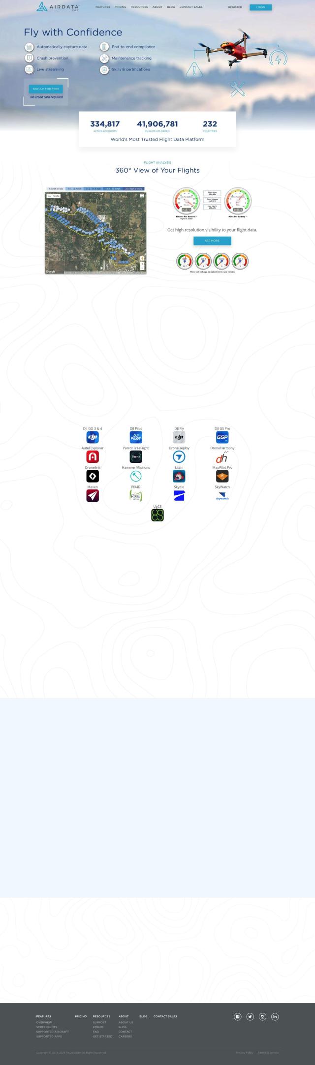
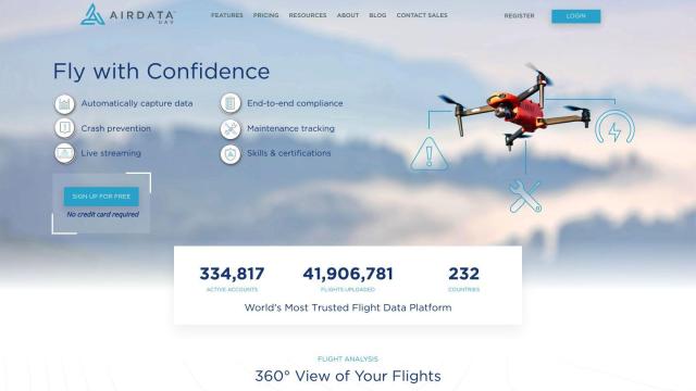
Airdata screenshot thumbnail

Airdata

If you're looking for a service that offers advanced analytics and alerts for potential problems with drone flights, Airdata is an excellent choice. This service provides a comprehensive suite of flight data management and analysis tools, including advanced analytics, maintenance tracking, and customizable reporting. It offers a 360-degree view of flights, proactive maintenance, and an alert system for critical issues, making it easier to ensure safer and more reliable drone operations. The service is suitable for both recreational and commercial users, with tiered pricing plans to accommodate different needs.
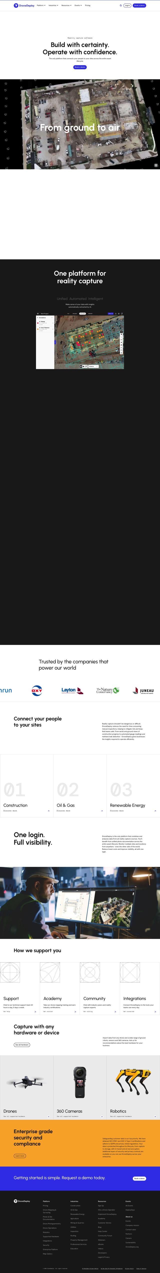
DroneDeploy screenshot thumbnail

DroneDeploy

Another noteworthy option is DroneDeploy, which combines drone mapping and photo documentation with AI-powered data extraction. While it is designed for broader asset lifecycle tracking, it aggregates data from various sources, including drones, and provides intelligent insights. This platform is particularly useful in industries like construction, oil and gas, and renewable energy, helping users track progress and identify potential issues. DroneDeploy offers training and certification programs, making it a robust solution for enterprise-level operations.
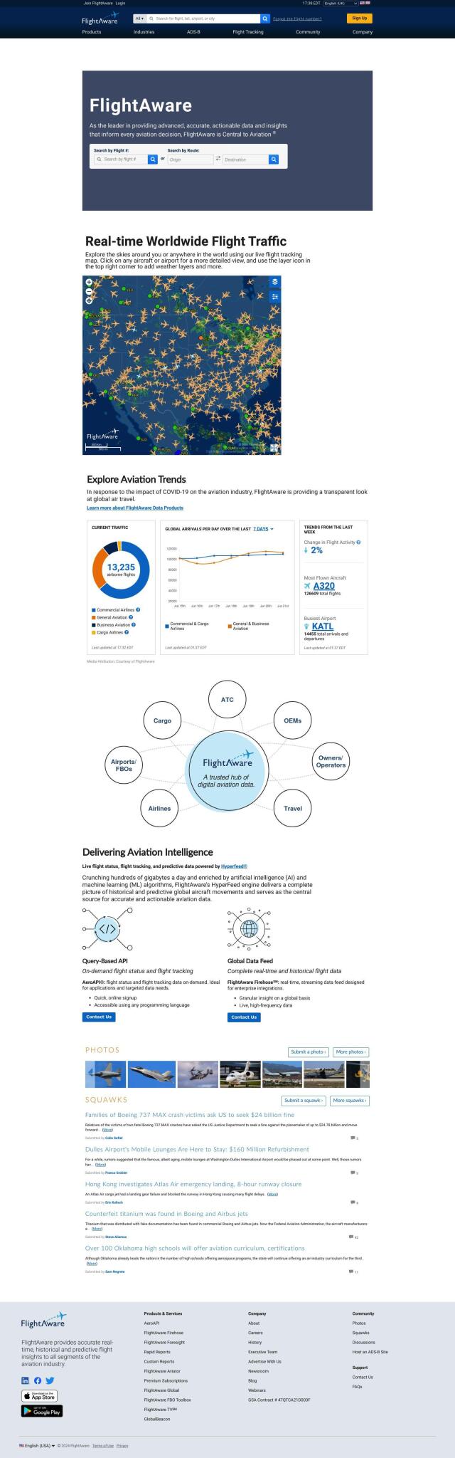
FlightAware screenshot thumbnail

FlightAware

For those in need of real-time aviation data and predictive insights, FlightAware is a valuable resource. It offers live tracking maps, flight status, and airport delays for commercial and private aircraft. The HyperFeed engine uses AI and ML algorithms to process large amounts of data, providing historical and predictive global aircraft movement insights. This service is particularly useful for aviation professionals and companies requiring granular data solutions.

Additional AI Projects

Skydio screenshot thumbnail

Skydio

Capture detailed data in challenging environments with AI-powered autonomous drones, featuring ultra-high resolution cameras and obstacle avoidance.

FlyPix screenshot thumbnail

FlyPix

Detect, localize, track, and monitor objects across industries with advanced AI models, generating actionable, geo-referenced insights from complex imagery.

PIX4D screenshot thumbnail

PIX4D

Converts images into accurate maps and 3D models for analysis, inspections, and measurements, with survey-grade accuracy and georeferencing.

AI Clearing screenshot thumbnail

AI Clearing

Generates 3D site reports with 100% site coverage, providing accurate and efficient progress monitoring, reducing re-work costs and litigation risks.

OnSolve screenshot thumbnail

OnSolve

Identify threats in real-time with AI-powered detection, and respond quickly with precision, reducing risk and ensuring timely action.

Nearmap screenshot thumbnail

Nearmap

Transforms high-resolution aerial imagery into actionable insights with AI predictions, 3D modeling, and geospatial tools for informed business decisions.

Meteomatics screenshot thumbnail

Meteomatics

Access global high-resolution weather, ocean, environment, and climate data through a comprehensive API, including historical, real-time, and forecast data up to 2100.

Cawamo screenshot thumbnail

Cawamo

Turns existing cameras into smart tools with multi-level AI video analytics, detecting people, vehicles, fires, and more, enhancing security and business intelligence.

SmartDrive screenshot thumbnail

SmartDrive

Video-based safety platform providing insights into driver performance, identifying risky behaviors, and optimizing transportation data to reduce collisions and operating costs.

Eagle Eye Networks screenshot thumbnail

Eagle Eye Networks

Cloud-based video surveillance system with AI analytics for enhanced security and business operations, accessible anywhere, on any device, with unlimited scalability.

Ambient.ai screenshot thumbnail

Ambient.ai

Automatically detects potential threats and verifies them visually in real-time, enabling proactive security and reducing response time.

Spot AI screenshot thumbnail

Spot AI

Turns video into actionable insights, improving safety and operations with AI-powered search, alerts, and collaboration tools for informed decision-making.

Edge Delta screenshot thumbnail

Edge Delta

Automates observability with real-time insights, AI-driven anomaly detection, and assisted troubleshooting, scaling to petabytes of data with flexible pipelines.

HEAVY.AI screenshot thumbnail

HEAVY.AI

Unlocks high-value opportunities and risks in location and time data through interactive, timely, and hardware-accelerated analytics.

Datadog screenshot thumbnail

Datadog

Provides real-time visibility into performance, security, and user experience across entire technology stacks, enabling swift troubleshooting and optimization.

Honeycomb screenshot thumbnail

Honeycomb

Combines logs and metrics into a single workflow, with AI-powered query assistance, to quickly identify and resolve problems in distributed services.

Neuraspace screenshot thumbnail

Neuraspace

Automatically assesses risks and suggests maneuvers up to 5 days before a conjunction, enabling earlier identification of high-risk collisions and more efficient operations.

Elastic screenshot thumbnail

Elastic

Combines search and AI to extract meaningful insights from data, accelerating time to insight and enabling tailored experiences.

Daydream screenshot thumbnail

Daydream

Unify data, context, and team collaboration to drive informed decisions, with AI-powered connections and expert-built templates for instant business insights.

GoodData screenshot thumbnail

GoodData

Quickly build custom data products with interactive analytics abilities, leveraging AI-powered features like a no-code interface and chat assistant for effortless insights.

Dataloop screenshot thumbnail

Dataloop

Unify data, models, and workflows in one environment, automating pipelines and incorporating human feedback to accelerate AI application development and improve quality.