ePlant Alternatives

Remotely monitor tree health and environmental conditions with long-range wireless sensors, tracking growth, stress, and weather patterns for data-driven decisions.
EOSDA screenshot thumbnail

EOSDA

If you're looking for another alternative to ePlant, EOSDA is a good choice. EOSDA is a geospatial data analytics platform that uses satellite imagery and machine learning algorithms to help with agriculture, forestry and sustainability. It includes tools for precision agriculture and forestry, like crop monitoring, yield forecasting and soil moisture analysis, that can help you increase profitability and reduce waste.

Nearmap screenshot thumbnail

Nearmap

Another interesting platform is Nearmap, which offers high-resolution imagery and 3D modeling. It uses AI to create datasets for property attributes and has tools for environmental monitoring. The platform can be used for urban planning, infrastructure, emergency response and even some agricultural uses, so it's a good option for a variety of industries.
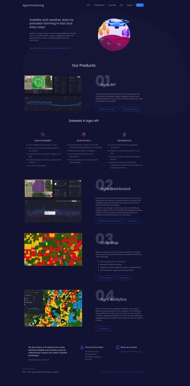
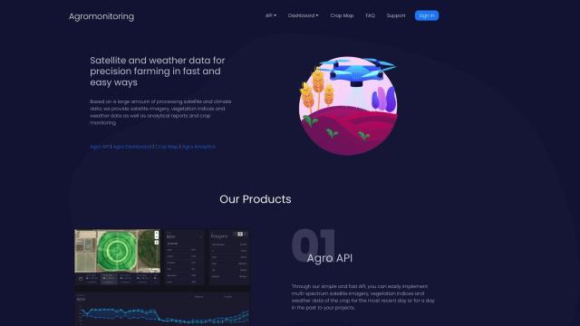
Agromonitoring screenshot thumbnail

Agromonitoring

Agromonitoring (project/agromonitoring) also has a powerful precision farming offering. It combines satellite and weather data to offer tools for crop management, including Agro API for integrating data into projects, Agro Dashboard for monitoring fields and Crop Map for detailed crop condition analysis. It's geared for farmers and companies that need crop management insights in real time.

Esri screenshot thumbnail

Esri

If you're looking for a broader spatial analytics offering, Esri offers GIS mapping software and spatial analytics tools. It includes features like 3D visualization, location intelligence and real-time decision-making that can be used in a variety of fields including agriculture, infrastructure planning and climate action.

More Alternatives to ePlant

Hexagon screenshot thumbnail

Hexagon

Combines sensor, software, and autonomous technologies to increase efficiency, reduce waste, and improve sustainability across industries through data-driven digital reality solutions.

Cropwise screenshot thumbnail

Cropwise

Optimizes farm operations and crop performance through integrated tools and services, providing real-time monitoring, data-driven insights, and personalized recommendations.

CARTO screenshot thumbnail

CARTO

Analyze and visualize spatial data at any scale with native cloud integration, intuitive drag-and-drop interface, and built-in GenAI capabilities.

Pl@ntNet screenshot thumbnail

Pl@ntNet

Identify plants from photos using image recognition technology, and contribute to biodiversity research by reporting observations and exploring species near your location.

AI Clearing screenshot thumbnail

AI Clearing

Generates 3D site reports with 100% site coverage, providing accurate and efficient progress monitoring, reducing re-work costs and litigation risks.

PictureThis screenshot thumbnail

PictureThis

Instantly identify plants, diagnose diseases, and receive personalized care tips with AI-powered plant identification and expert advice.

Elicit screenshot thumbnail

Elicit

Quickly search, summarize, and extract information from over 125 million academic papers, automating tedious research tasks and uncovering hidden trends.

Semantic Scholar screenshot thumbnail

Semantic Scholar

Discover and organize relevant scientific papers with AI-powered search, filtering, and recommendation features, streamlining research and collaboration.

Spatial.ai screenshot thumbnail

Spatial.ai

Unlock deeper customer insights with behavioral segmentation tools, profiling social, mobile, and web behavior to inform targeted marketing and location strategies.

Encord screenshot thumbnail

Encord

Streamline computer vision development with automated labeling, data management, and model testing tools to build more accurate models faster.

Spotfire screenshot thumbnail

Spotfire

Integrate, prepare, analyze, and act on data from multiple sources with a single platform for real-time data exploration and point-and-click data science.

Consensus screenshot thumbnail

Consensus

Quickly find and understand the most relevant and authoritative science and research papers with AI-powered search, insights, and proprietary filters.

C3 AI screenshot thumbnail

C3 AI

Access a broad range of pre-built, enterprise-scale AI applications across industries, accelerating digital transformation and delivering results in weeks.

Tomorrow.io screenshot thumbnail

Tomorrow.io

Combines global spacecraft data, AI/ML models, and advanced forecasting to provide hyper-accurate weather information for any location, enabling proactive decision-making and resilience.

Datadog screenshot thumbnail

Datadog

Provides real-time visibility into performance, security, and user experience across entire technology stacks, enabling swift troubleshooting and optimization.

Appen screenshot thumbnail

Appen

Fuel AI innovation with high-quality, diverse datasets and a customizable platform for human-AI collaboration, data annotation, and model testing.

Epsilon screenshot thumbnail

Epsilon

Accelerate scientific research with AI-driven citation discovery, paper summarization, and result synthesis, streamlining evidence-based information gathering and analysis.

Geotab screenshot thumbnail

Geotab

Leverage AI-driven insights and recommendations to optimize fleet operations, improve safety, and reduce emissions, while automating compliance and increasing productivity.

AIGardenPlanner screenshot thumbnail

AIGardenPlanner

Get personalized plant recommendations, intelligent plant pairing, and detailed guidance for a better harvest, tailored to your specific garden conditions and needs.

OpenRead screenshot thumbnail

OpenRead

Accelerate research with AI-driven tools, including a powerful search function, paper summarization, and Q&A features, to uncover insights and connections.