CARTO Alternatives

Analyze and visualize spatial data at any scale with native cloud integration, intuitive drag-and-drop interface, and built-in GenAI capabilities.
Esri screenshot thumbnail

Esri

If you're looking for a CARTO alternative, Esri is another top option. Its GIS mapping software and spatial analytics tools can provide location intelligence and competitive edge by marrying location analytics with machine learning. It's got 3D visualization, GIS mapping, spatial analysis and real-time decision-making abilities and can be used across a broad range of industries and use cases. It can be run on cloud infrastructure or on-premise and offers a 21-day free trial.

Mapbox screenshot thumbnail

Mapbox

Another good option is Mapbox. The company's APIs and SDKs let developers add customizable maps, advanced navigation, location search and rich geospatial data to their apps. It offers interactive maps that can be updated in real time, advanced routing engines and location search, and access to global data sets. Mapbox customers include major companies using it for connected navigation, weather forecasting and data analysis, and it offers a free tier with volume discounts and annual contracts to cut costs.

MapmyIndia screenshot thumbnail

MapmyIndia

If you're looking for a location-based products and services option, check out MapmyIndia. It's a suite of solutions built on India's most accurate maps, including integrated navigation, connected vehicle features and a range of location data and analytics tools. The platform is geared for industries like enterprise, automotive and government, and offers APIs and SDKs for developers to build their own experiences.
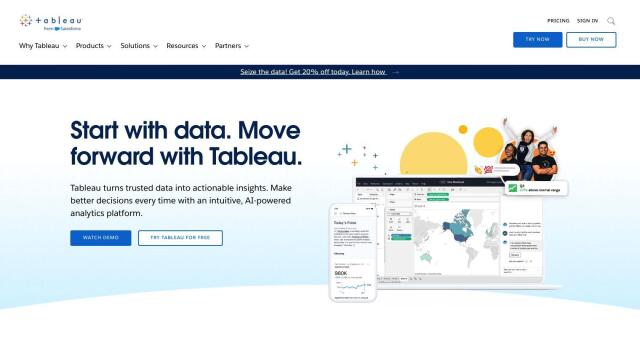
Tableau screenshot thumbnail

Tableau

Last, Tableau is a business intelligence and analytics platform that connects to a wide range of databases and lets people build visualizations through drag-and-drop interfaces. It can be used in the cloud, on-premises or in Salesforce CRM, and includes AI/ML abilities, governance and data management. Tableau has a reputation for easy-to-use products and a community-driven approach, so it's a good option for those who want to optimize operations and delight customers.

More Alternatives to CARTO

Nearmap screenshot thumbnail

Nearmap

Transforms high-resolution aerial imagery into actionable insights with AI predictions, 3D modeling, and geospatial tools for informed business decisions.

ThoughtSpot screenshot thumbnail

ThoughtSpot

Ask complex data questions in natural language and get instant AI-powered insights, empowering informed business decisions without requiring SQL or data expertise.

Placekey screenshot thumbnail

Placekey

Assigns a unique identifier to any physical location, standardizing address information for easy data sharing and integration across organizations.

Radar screenshot thumbnail

Radar

Radar combines geofencing, geocoding, and mapping for accurate, cost-effective location-based experiences.

GoodData screenshot thumbnail

GoodData

Quickly build custom data products with interactive analytics abilities, leveraging AI-powered features like a no-code interface and chat assistant for effortless insights.

Unearth Insights screenshot thumbnail

Unearth Insights

Access a unified suite of location data and analytics tools, powered by an AI co-pilot, to uncover insights and drive business decisions faster.

Spatial.ai screenshot thumbnail

Spatial.ai

Unlock deeper customer insights with behavioral segmentation tools, profiling social, mobile, and web behavior to inform targeted marketing and location strategies.

DataGPT screenshot thumbnail

DataGPT

Get instant, analyst-level answers to data questions in seconds, with automated insights and visualizations, making complex data analysis accessible to everyone.

Zing Data screenshot thumbnail

Zing Data

Get answers to data questions in seconds, without expertise, using intuitive natural language querying and automated data modeling.

Onvo screenshot thumbnail

Onvo

Create interactive charts and insights with simple AI prompts, eliminating the need for complex queries and customizations.

EOSDA screenshot thumbnail

EOSDA

Utilizes satellite data and machine learning to provide actionable insights for sustainable agriculture and forestry, enabling data-driven decision making and reduced waste.

Sisense screenshot thumbnail

Sisense

Embed AI-infused analytics into products and applications with customizable look and feel, connecting data from multiple sources for personalized insights.

Oracle Health screenshot thumbnail

Oracle Health

Oracle's integrated cloud stack delivers consistent processes and data across the enterprise efficiently.

Alteryx screenshot thumbnail

Alteryx

Automates workflows, delivers self-service insights, and aligns data analysis with strategic business outcomes, empowering enterprise analytics for all users and roles.

Tabula screenshot thumbnail

Tabula

Automate data workflows, standardize disparate sources, and gain real-time insights without coding, empowering data-driven decision-making across departments.

Canvas screenshot thumbnail

Canvas

Link, query, and visualize data from 150+ SaaS tools without coding, empowering non-technical teams to make data-informed decisions.

Cloudera screenshot thumbnail

Cloudera

Unifies and processes massive amounts of data from multiple sources, providing trusted insights and fueling AI model development across cloud and on-premises environments.

Hex screenshot thumbnail

Hex

Unify data teams with AI-assisted exploration, collaboration, and interactive reporting, accelerating data work and improving accuracy in a single, modular workspace.

Hexagon screenshot thumbnail

Hexagon

Combines sensor, software, and autonomous technologies to increase efficiency, reduce waste, and improve sustainability across industries through data-driven digital reality solutions.

PlaceKit screenshot thumbnail

PlaceKit

Fast, accurate, and global address search with autocomplete, geocoding, and store locator features for seamless user experiences and efficient address management.