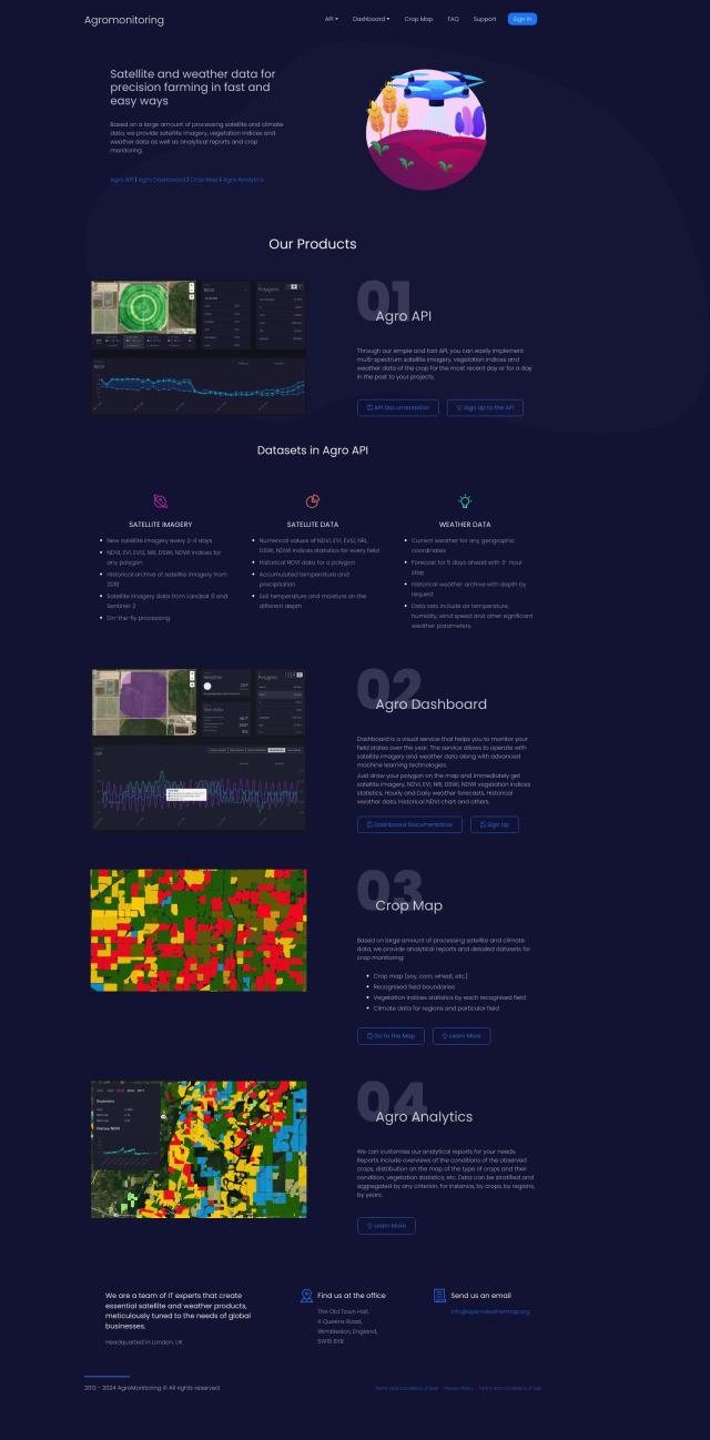
Question: I'm looking for a solution that can detect changes and anomalies in satellite or aerial imagery over time.

FlyPix screenshot thumbnail

FlyPix

If you need something that can spot changes and anomalies in satellite or aerial imagery over time, FlyPix is a good choice. The AI-powered geospatial solutions platform processes complex imagery into useful information and can perform object detection, localization, tracking and monitoring. It's good for a range of industries, and includes tools for detailed object analysis, change detection and dynamic tracking, so it should meet your needs.
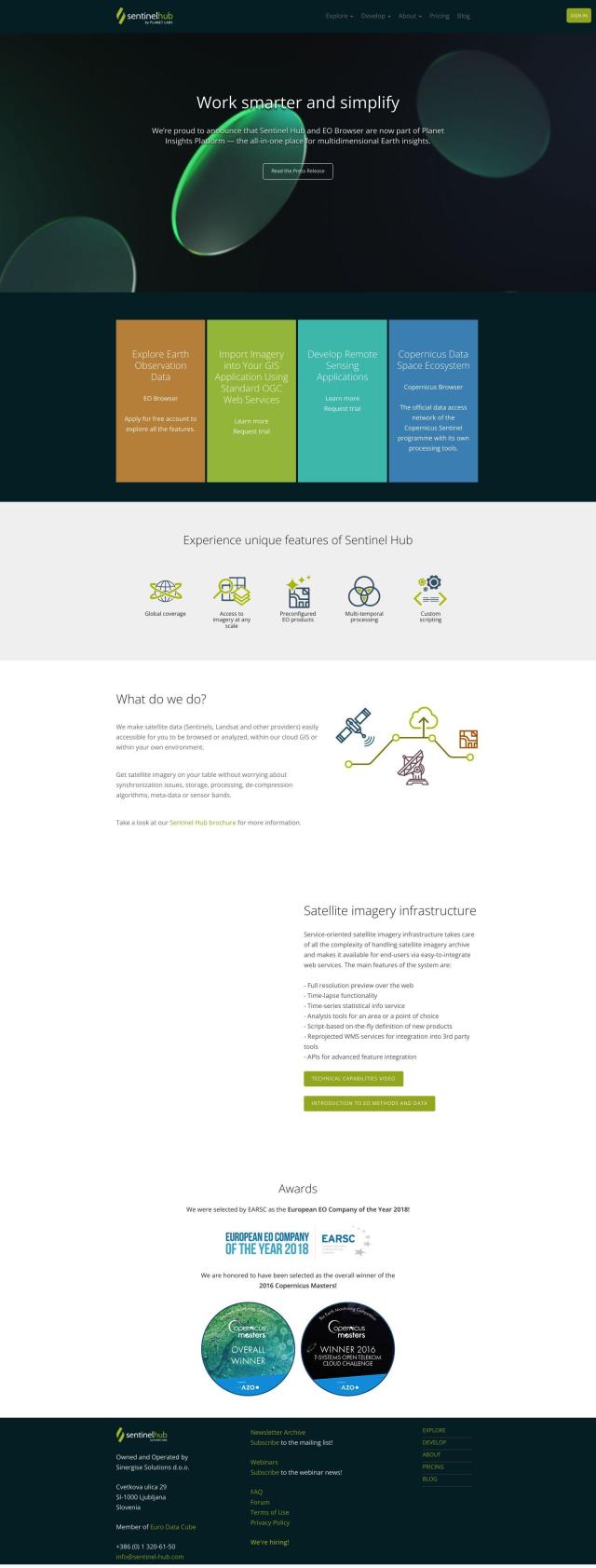
Sentinel Hub screenshot thumbnail

Sentinel Hub

Another option is Sentinel Hub, a cloud-based API that makes it easier to get satellite imagery from sources like Sentinels and Landsat. It includes a range of tools like EO Browser for getting the imagery, statistical information services and custom visualizations. Sentinel Hub handles the heavy lifting of data processing and synchronization so you can concentrate on the analysis and applications, which makes it a good option for anyone dealing with lots of satellite imagery.

EOSDA screenshot thumbnail

EOSDA

For ag and forestry businesses, EOSDA offers a geospatial data analytics platform that uses satellite imagery and machine learning to provide insights into crop monitoring, yield forecasting and forest monitoring. EOSDA's tools like LandViewer and high-resolution satellite imagery make it a good practical and environmentally friendly option for companies looking to make better decisions and cut waste.

Nearmap screenshot thumbnail

Nearmap

Last, Nearmap offers a location intelligence platform that includes high-resolution imagery, 3D modeling and AI predictions. It offers a variety of tools for 3D visualization, disaster response and environmental monitoring, so it's a good option for companies in insurance, construction, real estate, agriculture and other businesses.

Additional AI Projects

Agromonitoring screenshot thumbnail

Agromonitoring

Provides precision farming insights through satellite imagery, vegetation indices, and weather data, empowering data-driven crop management and decision-making.

PIX4D screenshot thumbnail

PIX4D

Converts images into accurate maps and 3D models for analysis, inspections, and measurements, with survey-grade accuracy and georeferencing.

Skydio screenshot thumbnail

Skydio

Capture detailed data in challenging environments with AI-powered autonomous drones, featuring ultra-high resolution cameras and obstacle avoidance.

Hexagon screenshot thumbnail

Hexagon

Combines sensor, software, and autonomous technologies to increase efficiency, reduce waste, and improve sustainability across industries through data-driven digital reality solutions.

Ximilar screenshot thumbnail

Ximilar

Train custom image recognition models with your own labels and categories, and integrate them into your systems for automated tagging, search, and object detection.

Imagga screenshot thumbnail

Imagga

Automatically tag, categorize, and search images with customizable machine learning technology for smart applications.

Segment Anything Model screenshot thumbnail

Segment Anything Model

Segments objects in any image with a single click, generalizing to unknown objects and images without further training, using interactive points, boxes, or text prompts.

Neuraspace screenshot thumbnail

Neuraspace

Automatically assesses risks and suggests maneuvers up to 5 days before a conjunction, enabling earlier identification of high-risk collisions and more efficient operations.

Cawamo screenshot thumbnail

Cawamo

Turns existing cameras into smart tools with multi-level AI video analytics, detecting people, vehicles, fires, and more, enhancing security and business intelligence.

Edge Delta screenshot thumbnail

Edge Delta

Automates observability with real-time insights, AI-driven anomaly detection, and assisted troubleshooting, scaling to petabytes of data with flexible pipelines.

Atmo screenshot thumbnail

Atmo

Produces high-resolution, real-time weather forecasts with up to 50% greater accuracy and 40,000 times faster processing than traditional models.

Observo screenshot thumbnail

Observo

Automates observability pipelines, optimizing data for 50%+ cost savings and 40% faster incident resolution with intelligent data routing and reduction.

Splunk screenshot thumbnail

Splunk

Unify security and observability with AI-driven insights to accelerate digital transformation and resilience.

Ambient.ai screenshot thumbnail

Ambient.ai

Automatically detects potential threats and verifies them visually in real-time, enabling proactive security and reducing response time.

ArcSoft screenshot thumbnail

ArcSoft

Enhances image quality and user experience with cutting-edge computer vision technologies for various devices and applications.

Metaplane screenshot thumbnail

Metaplane

Automates end-to-end data observability, detecting anomalies and data quality issues in real-time, enabling data teams to resolve problems quickly and confidently.

Elastic screenshot thumbnail

Elastic

Combines search and AI to extract meaningful insights from data, accelerating time to insight and enabling tailored experiences.

Calipsa screenshot thumbnail

Calipsa

Extracts intelligence from video surveillance in real-time, detecting objects, filtering false alarms, and providing customizable alerts for enhanced security operations.

ServiceNow Cloud Observability screenshot thumbnail

ServiceNow Cloud Observability

Uses AI to spot problems and respond to changes in cloud-native and monolithic applications, improving uptime and reducing mean time to resolution.

Spot AI screenshot thumbnail

Spot AI

Turns video into actionable insights, improving safety and operations with AI-powered search, alerts, and collaboration tools for informed decision-making.