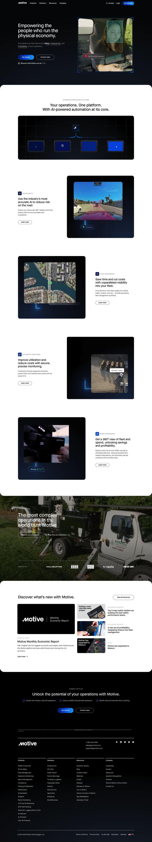
Question: Can you recommend a platform that provides a comprehensive view of vehicle and road conditions to improve fleet safety?

Cambridge Mobile Telematics screenshot thumbnail

Cambridge Mobile Telematics

If you want a broad platform that offers a unified view of vehicle and road data to help you keep your fleet safe, Cambridge Mobile Telematics is a good option. The telematics service provider combines data from IoT sources like smartphones, connected cars and dashcams with sensor data and contextual information. It offers risk assessment, safety, claims and driver improvement programs for auto insurers, carmakers, commercial mobility companies and the public sector. The platform can help fleets cut risky behavior like phone distraction and speeding, so it's a good option for fleet safety.

Geotab screenshot thumbnail

Geotab

Another good option is Geotab, a GPS fleet tracking and management system. Geotab uses AI and data intelligence to provide insights and recommendations to help fleets run better. Its services include AI-powered fleet safety, driver coaching and route optimization. It also can help fleets cut costs through process automation and can help them go greener by tracking fuel use and emissions. More than 50,000 customers use Geotab, so it's a good option for fleet management.
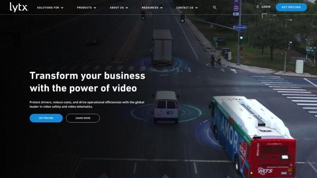
Lytx screenshot thumbnail

Lytx

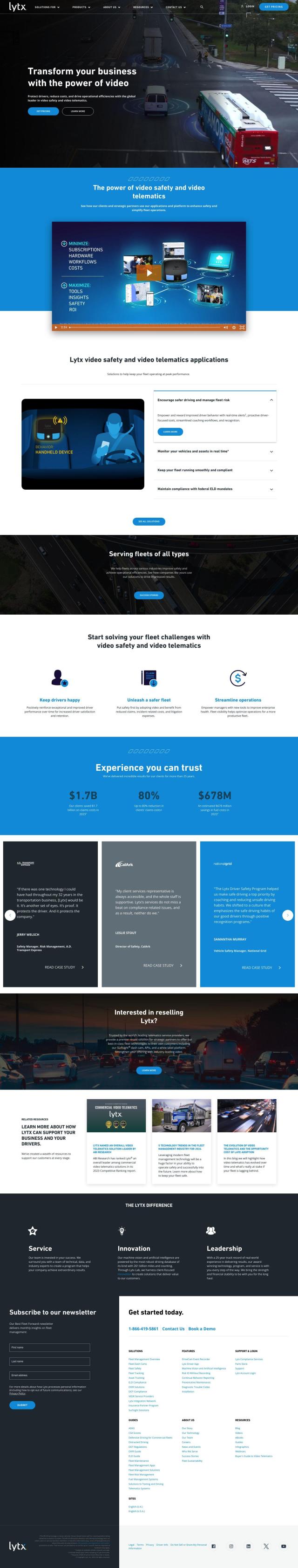
Lytx is another option, offering an all-in-one fleet management system that combines hardware, software and APIs for a single view of fleet operations. Its services include video-based safety and telematics services, real-time alerts, coaching and monitoring. Lytx's system is designed to help fleets improve safety, efficiency, compliance and driver retention, and customers have reported big savings in claims costs and fuel costs. Lytx has 25 years of experience, so it's a good option if you're looking for a tried and true fleet management option.
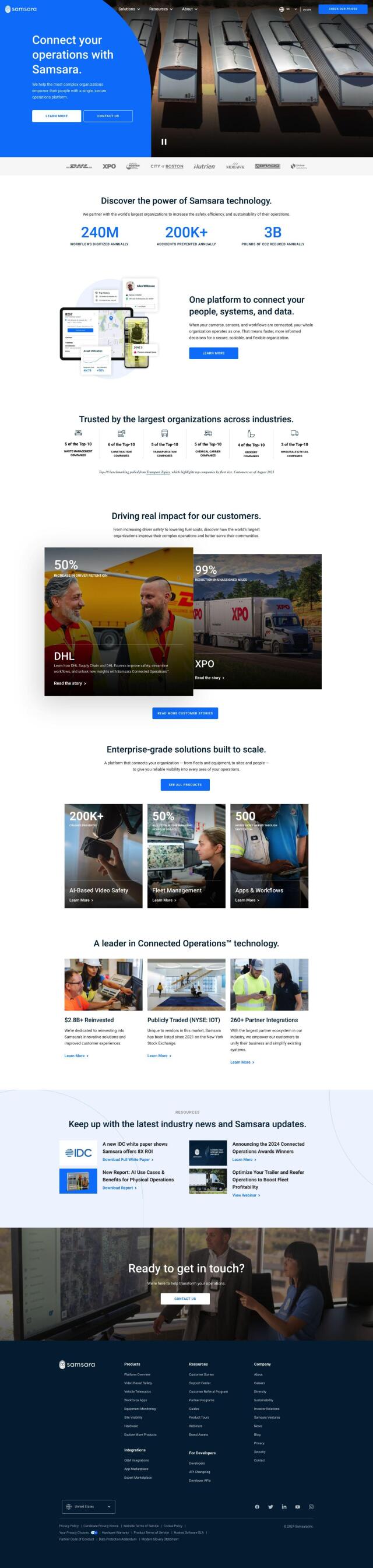
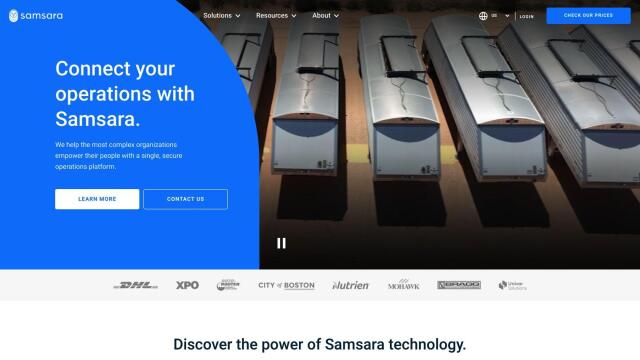
Samsara screenshot thumbnail

Samsara

If you want something more flexible, check out Samsara, which offers a fleet operations platform to help large companies across many industries improve safety, efficiency and sustainability. Samsara combines AI-powered dash cams, real-time GPS, telematics, maintenance, routing and a driver app for video-based safety, vehicle telematics and equipment monitoring. The platform is customizable and can integrate with existing systems, so it's a good option for complex fleet operations.

Additional AI Projects

Motive screenshot thumbnail

Motive

Optimizes fleet management across safety, maintenance, and spend with AI-powered automation, providing 360° visibility and real-time insights to increase efficiency and profitability.

Omnitracs screenshot thumbnail

Omnitracs

Combines fleet management expertise with AI and machine learning to provide actionable insights, optimize business performance, and improve driver satisfaction and safety.

INRIX screenshot thumbnail

INRIX

Harnesses 50 petabytes of transportation data to provide real-time traffic insights, crash alerts, and parking analytics, optimizing urban mobility and road safety.

Mojio screenshot thumbnail

Mojio

Unlocks the full potential of car data monetization, providing actionable insights and services for a smarter, safer, and more convenient car ownership experience.

Sentiance screenshot thumbnail

Sentiance

Provides real-time driving insights, crash detection, and mobility analysis to improve road safety, reduce risks, and promote sustainable transportation.

Arity screenshot thumbnail

Arity

Analyzes trillions of miles of driving data to provide actionable insights for insurers, marketers, and communities, enabling personalized services and targeted solutions.

Solera screenshot thumbnail

Solera

Automates claims processes with AI-powered workflows, streamlining vehicle management and maintenance through integrated software solutions.

Bytebeam screenshot thumbnail

Bytebeam

Manage connected vehicles with real-time health monitoring, over-the-air updates, and remote diagnostics, accelerating go-to-market and improving the driving experience.

Flock Safety screenshot thumbnail

Flock Safety

Combines License Plate Recognition, gunshot detection, and video intelligence to provide law enforcement agencies and communities with a comprehensive crime-solving platform.

Quanata screenshot thumbnail

Quanata

Provides contextual risk prediction and mitigation solutions for insurers, leveraging AI-powered modeling, real-time telematics, and risk-based acquisition capabilities.

CCC Intelligent Solutions screenshot thumbnail

CCC Intelligent Solutions

Empowers intelligent experiences for P&C insurance stakeholders through personalized, efficient, and seamless interactions, driven by data, AI, and ecosystem connections.

Mobileye screenshot thumbnail

Mobileye

Utilizes a single, low-cost camera sensor to improve vehicle safety, enabling advanced driver-assist systems and self-driving solutions for the automotive industry.

MapmyIndia screenshot thumbnail

MapmyIndia

Seamlessly navigate and optimize last-mile operations with integrated navigation, route planning, and location intelligence solutions powered by India's best maps.

DispatchTrack screenshot thumbnail

DispatchTrack

AI-optimized routes and real-time order tracking improve last-mile delivery customer satisfaction, promising speed, precision, and personalized experiences.

Nearmap screenshot thumbnail

Nearmap

Transforms high-resolution aerial imagery into actionable insights with AI predictions, 3D modeling, and geospatial tools for informed business decisions.

Turing AI screenshot thumbnail

Turing AI

Intelligently search video feeds with advanced capabilities, receive real-time alerts, and share clips instantly to enhance safety and security operations.

Polymath Robotics screenshot thumbnail

Polymath Robotics

Simplifies autonomous navigation for industrial off-highway vehicles, enabling easy automation without extensive robotics expertise.

Shipsy screenshot thumbnail

Shipsy

Optimizes end-to-end logistics and supply chain operations with automated route planning, freight procurement, and shipment tracking for improved efficiency and cost reduction.

Radar screenshot thumbnail

Radar

Radar combines geofencing, geocoding, and mapping for accurate, cost-effective location-based experiences.

Beams screenshot thumbnail

Beams

Automatically detects and tracks hazards and risks in high-stakes business environments, improving safety and risk assessment with AI-powered analysis and reporting.