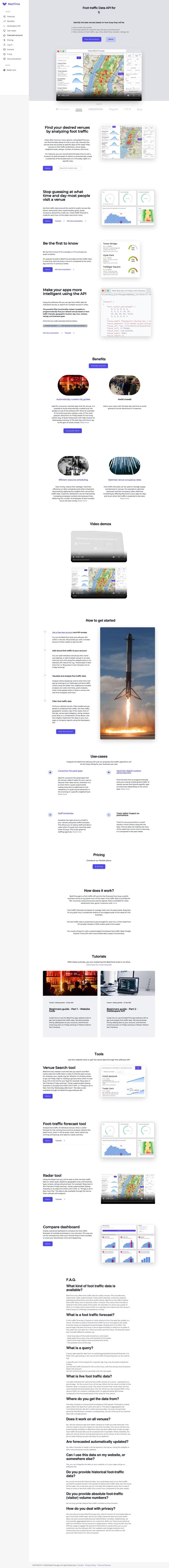
Question: Can you suggest a solution for building a store locator that finds the nearest points of interest to a user's location?

PlaceKit screenshot thumbnail

PlaceKit

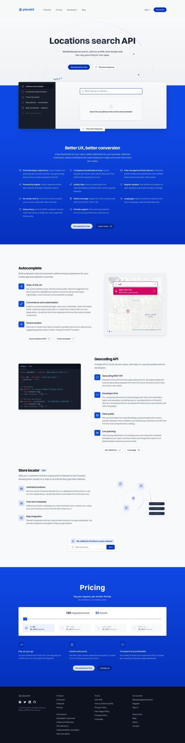
For building a store locator that can find the nearest points of interest to a user's location, PlaceKit is a good option. This geocoding API and autocomplete service has a built-in store locator feature with unlimited location settings and live patching for the latest addresses. It works in 246 countries and supports many languages for global reach, and it can be used with any map provider for mapping integration.

Mapbox screenshot thumbnail

Mapbox

Another good option is Mapbox, a location intelligence platform that offers customizable maps, advanced navigation and precise location search. Its interactive maps can be updated in real-time, and it offers access to global datasets for boundaries, traffic and movement. It's used by many industry leaders, and there's a free tier, so it's a good option for those who want to get started without breaking the bank.

Radar screenshot thumbnail

Radar

If you're looking for a service that's got a particular focus on accuracy and privacy, Radar is an option. Radar offers hyper-accurate geofencing, powerful mapping and live ETAs. It also integrates with popular tools like Segment and Braze to make your life easier while you're building. Radar's tiered pricing, including a free option, means you can use it at a level that's right for your needs.

Placekey screenshot thumbnail

Placekey

If you're looking for a more neutral approach to location identification, Placekey offers a standardized way to handle location data. Placekey offers a single identifier for any address, which means no more address matching problems. It works with a wide range of platforms and offers a variety of pricing tiers, so it's a good option for collaborators working across different companies and industries.

Additional AI Projects

CARTO screenshot thumbnail

CARTO

Analyze and visualize spatial data at any scale with native cloud integration, intuitive drag-and-drop interface, and built-in GenAI capabilities.

Esri screenshot thumbnail

Esri

Uncover hidden patterns and drive predictive modeling with spatial analytics and machine learning, combining location-based data for innovative insights.

Flybuy screenshot thumbnail

Flybuy

Provides accurate location intelligence, going beyond traditional geofence technology, to improve guest experience and streamline operations for various industries.

MapmyIndia screenshot thumbnail

MapmyIndia

Seamlessly navigate and optimize last-mile operations with integrated navigation, route planning, and location intelligence solutions powered by India's best maps.

Bluedot screenshot thumbnail

Bluedot

Empowers apps to send targeted messages and automate tasks with 20x accurate location detection, down to five meters, for seamless customer experiences.

Nearmap screenshot thumbnail

Nearmap

Transforms high-resolution aerial imagery into actionable insights with AI predictions, 3D modeling, and geospatial tools for informed business decisions.

Loqate screenshot thumbnail

Loqate

Enhance address data quality and user experience with fast and accurate capture, verification, and geocoding technology for 249 countries and territories.

Yext screenshot thumbnail

Yext

Manages and delivers consistent, accurate, and engaging experiences across multiple digital touchpoints, personalizing interactions and automating workflows to save time and money.

INRIX screenshot thumbnail

INRIX

Harnesses 50 petabytes of transportation data to provide real-time traffic insights, crash alerts, and parking analytics, optimizing urban mobility and road safety.

Spatial.ai screenshot thumbnail

Spatial.ai

Unlock deeper customer insights with behavioral segmentation tools, profiling social, mobile, and web behavior to inform targeted marketing and location strategies.

Unearth Insights screenshot thumbnail

Unearth Insights

Access a unified suite of location data and analytics tools, powered by an AI co-pilot, to uncover insights and drive business decisions faster.

BestTime screenshot thumbnail

BestTime

Provides real-time retail foot traffic data, forecasts, and live activity insights for locations worldwide, enabling informed decisions on visitation and operations.

MapsGPT screenshot thumbnail

MapsGPT

Instantly generate custom maps with pins for specific activities, trips, or atmospheres, and discover unique locations with a range of search options.

Local Falcon screenshot thumbnail

Local Falcon

Visualize and optimize local search rankings with AI-driven insights and customized suggestions on a geo-grid map interface, empowering data-driven local SEO decisions.

Textomap screenshot thumbnail

Textomap

Automatically extracts locations from text-based content to create interactive maps in seconds, saving time and effort.

IP Lookup Geolocation API screenshot thumbnail

IP Lookup Geolocation API

Retrieve detailed geolocation information for an IP address, including type, business details, and location data, to personalize user experiences and serve targeted content.

OpenSearch screenshot thumbnail

OpenSearch

Build scalable, high-performance search solutions with out-of-the-box performance, machine learning integrations, and powerful analytics capabilities.

Geotab screenshot thumbnail

Geotab

Leverage AI-driven insights and recommendations to optimize fleet operations, improve safety, and reduce emissions, while automating compliance and increasing productivity.

PubNub screenshot thumbnail

PubNub

Connect devices, humans, and AI systems for real-time interactions across various use cases.

LocaliQ screenshot thumbnail

LocaliQ

Empowers businesses to attract, convert, and retain customers through AI-driven solutions, capturing and qualifying leads to free up time for revenue-generating activities.