Question: Are there any autonomous systems that can be used for oil and gas inspection and monitoring?

Skydio screenshot thumbnail

Skydio

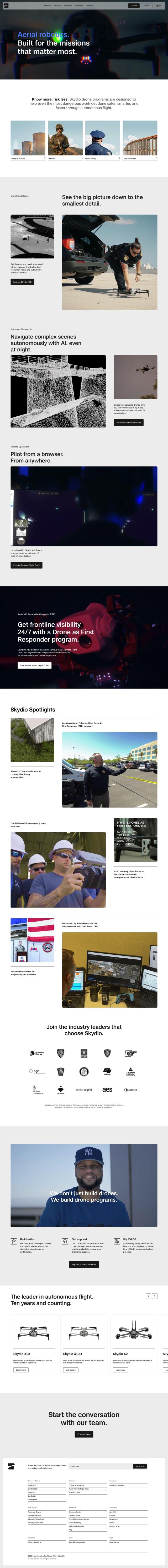
For inspecting and monitoring oil and gas operations with autonomous systems, Skydio provides aerial robotics capabilities with AI and high-resolution cameras. Drones can fly autonomously, gather detailed data and be piloted remotely, a good combination for inspecting difficult areas safely and efficiently.

DroneDeploy screenshot thumbnail

DroneDeploy

Another option is DroneDeploy, which marries drone mapping and photo documentation to track history and detect issues over an asset's lifetime. It's popular in the oil and gas industry, offering smart insights through AI-based data extraction and unified photo documentation.

Shield AI screenshot thumbnail

Shield AI

Shield AI offers the Hivemind AI pilot system, which can fly without GPS or human pilots. The technology can be used for oil and gas inspection, an approach that can be safer and more economical than traditional methods by autonomously interpreting data and making decisions.

Baker Hughes screenshot thumbnail

Baker Hughes

And Baker Hughes has a broad portfolio of energy technology and services, including oilfield operations. Its data-first approach and remote operations can help improve efficiency and lower emissions in the oil and gas industry.

Additional AI Projects

AIM screenshot thumbnail

AIM

Converts heavy equipment into autonomous machines, increasing productivity and safety, with 24/7 operation, 360-degree safety, and no risk of human error.

Zyfra screenshot thumbnail

Zyfra

Integrates digital and business processes to optimize industrial operations, improving production task management and control across various industries.

FlyPix screenshot thumbnail

FlyPix

Detect, localize, track, and monitor objects across industries with advanced AI models, generating actionable, geo-referenced insights from complex imagery.

Anduril screenshot thumbnail

Anduril

Delivers advanced awareness and security to the tactical edge through autonomous systems, combining AI and open operating systems for persistent threat detection and response.

Polymath Robotics screenshot thumbnail

Polymath Robotics

Simplifies autonomous navigation for industrial off-highway vehicles, enabling easy automation without extensive robotics expertise.

Hexagon screenshot thumbnail

Hexagon

Combines sensor, software, and autonomous technologies to increase efficiency, reduce waste, and improve sustainability across industries through data-driven digital reality solutions.

AI Clearing screenshot thumbnail

AI Clearing

Generates 3D site reports with 100% site coverage, providing accurate and efficient progress monitoring, reducing re-work costs and litigation risks.

PIX4D screenshot thumbnail

PIX4D

Converts images into accurate maps and 3D models for analysis, inspections, and measurements, with survey-grade accuracy and georeferencing.

OxBlue screenshot thumbnail

OxBlue

Process project photos to monitor activity, safety, and weather data, enabling informed decision-making with real-time visual insights.

Cyngn screenshot thumbnail

Cyngn

Autonomous industrial vehicles haul and tow thousands of pounds of payload, making decisions in real-time, while prioritizing workplace safety and increasing productivity.

SkyTruth screenshot thumbnail

SkyTruth

Leverages satellite imagery and AI to monitor environmental activity, empowering citizens and organizations to track and respond to issues like pollution, deforestation, and more.

Fleet Complete screenshot thumbnail

Fleet Complete

Combines telematics, GPS tracking, and AI-powered dash cameras to optimize fleet efficiency, safety, compliance, and sustainability with real-time insights and data visualizations.

Scale screenshot thumbnail

Scale

Provides high-quality, cost-effective training data for AI models, improving performance and reliability across various industries and applications.

Mobileye screenshot thumbnail

Mobileye

Utilizes a single, low-cost camera sensor to improve vehicle safety, enabling advanced driver-assist systems and self-driving solutions for the automotive industry.

Avride screenshot thumbnail

Avride

Enables safe and efficient transportation with precise positioning, resilient perception, versatile forecasting, and intelligent navigation for autonomous vehicles and robots.

Airdata screenshot thumbnail

Airdata

Unlock 360-degree views of flights, track maintenance, and create custom reports to optimize drone operations and ensure safer, more reliable flights.

Knightscope screenshot thumbnail

Knightscope

Autonomous security robots with 360-degree HD video streaming, people detection, and physical deterrence for enhanced public safety and crime reduction.

Dragos screenshot thumbnail

Dragos

Provides comprehensive visibility into OT environments, identifying vulnerabilities and threats, and offers actionable insights to improve industrial cybersecurity defenses.

IntelliShift screenshot thumbnail

IntelliShift

Unifies telematics, AI dash cams, inspections, compliance, and maintenance tools in a single interface, providing fleet managers with a deeper understanding of their operations.

Geotab screenshot thumbnail

Geotab

Leverage AI-driven insights and recommendations to optimize fleet operations, improve safety, and reduce emissions, while automating compliance and increasing productivity.