Question: Is there a technology that combines GNSS, IMU, and sensor data for precise positioning in real-time?

Point One screenshot thumbnail

Point One

If you're looking for a technology that combines GNSS, IMU, and sensor data for precise positioning in real-time, Point One has a mature solution. Point One's precision location stack offers centimeter-accurate globally-referenced position data through RTK corrections. It includes Atlas INS, which combines high precision GNSS with IMU and other sensor data for truth-level positioning in real-time. This end-to-end location solution is great for robotics, autonomy, survey, construction and precision agriculture, with fast setup and integration.

Movella screenshot thumbnail

Movella

Movella also offers a full motion capture technology that uses a variety of sensors to track motion and position. Their Xsens Motion Capture suite includes tools for logging data anywhere, making it good for gaming, film, sports and automation. It's not specifically a GNSS and IMU play, but it can be very useful for tracking precise position and orientation.
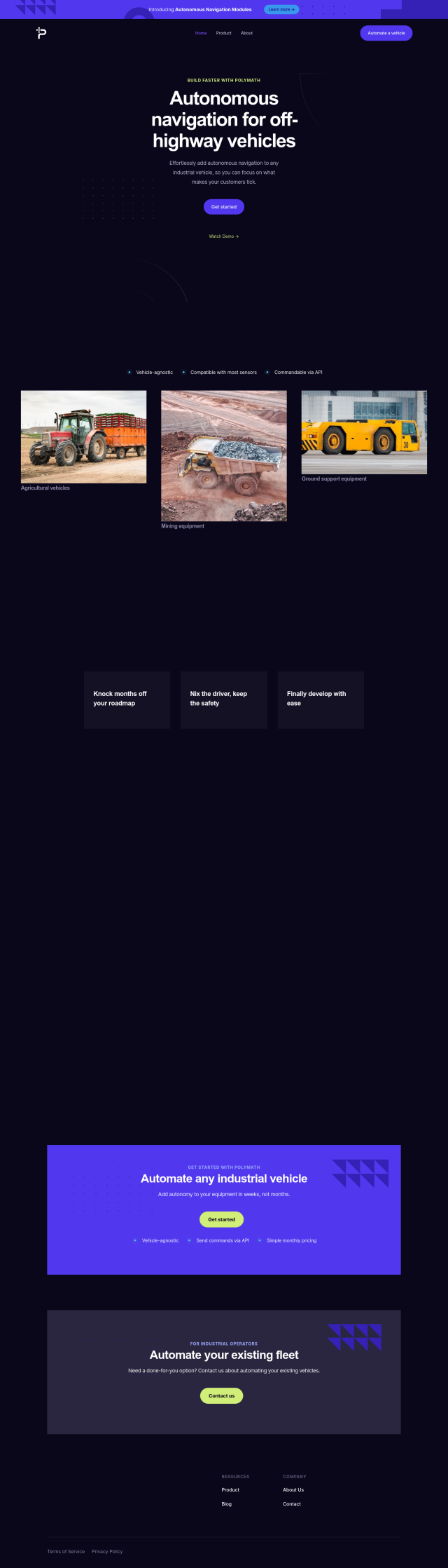
Polymath Robotics screenshot thumbnail

Polymath Robotics

If you're looking for autonomous navigation technology, Polymath Robotics has an autonomous navigation system for industrial off-highway vehicles. Its platform supports a variety of sensors and can be integrated with other software through APIs, offering features like waypoint navigation and obstacle detection. That can be useful for quickly automating fleets without a lot of robotics expertise.

Mobileye screenshot thumbnail

Mobileye

Although primarily focused on autonomous driving, Mobileye offers sophisticated sensor configurations, including GNSS and IMU, for precise positioning. Mobileye's technology is for autonomous mobility services and can be integrated with a wide range of vehicle types, offering better safety and performance in a variety of driving situations.

Additional AI Projects

Skydio screenshot thumbnail

Skydio

Capture detailed data in challenging environments with AI-powered autonomous drones, featuring ultra-high resolution cameras and obstacle avoidance.

Geotab screenshot thumbnail

Geotab

Leverage AI-driven insights and recommendations to optimize fleet operations, improve safety, and reduce emissions, while automating compliance and increasing productivity.

Radar screenshot thumbnail

Radar

Radar combines geofencing, geocoding, and mapping for accurate, cost-effective location-based experiences.

Hexagon screenshot thumbnail

Hexagon

Combines sensor, software, and autonomous technologies to increase efficiency, reduce waste, and improve sustainability across industries through data-driven digital reality solutions.

LocoNav screenshot thumbnail

LocoNav

AI-powered video technology analyzes traffic, identifies safety risks, and provides real-time alerts to mitigate risks and ensure a safer, more efficient fleet.

MapmyIndia screenshot thumbnail

MapmyIndia

Seamlessly navigate and optimize last-mile operations with integrated navigation, route planning, and location intelligence solutions powered by India's best maps.

Mapbox screenshot thumbnail

Mapbox

Create customizable, interactive maps with live-updating data and advanced navigation features for web, mobile, automotive, and AR applications.

aiMotive screenshot thumbnail

aiMotive

Accelerates development and validation of Automated Driving solutions with a broad range of embedded solutions and tooling, reducing costs and time-to-market.

Trackunit screenshot thumbnail

Trackunit

Connects people, machines, and processes to minimize downtime, optimize operations, and increase productivity in the construction industry.

FlyPix screenshot thumbnail

FlyPix

Detect, localize, track, and monitor objects across industries with advanced AI models, generating actionable, geo-referenced insights from complex imagery.

Teletrac Navman screenshot thumbnail

Teletrac Navman

Unify fleet operations with a single platform, tracking and optimizing vehicles, equipment, and drivers in real-time, improving safety, efficiency, and performance.

Cambridge Mobile Telematics screenshot thumbnail

Cambridge Mobile Telematics

Analyzes hundreds of billions of miles of driving data to provide a complete picture of vehicle and driver behavior, promoting safer driving and lower insurance rates.

AI Clearing screenshot thumbnail

AI Clearing

Generates 3D site reports with 100% site coverage, providing accurate and efficient progress monitoring, reducing re-work costs and litigation risks.

Driver•i screenshot thumbnail

Driver•i

Provides real-time insights into fleet operations, enabling proactive measures to prevent accidents, improve driver behavior, and optimize fleet performance.

Nearmap screenshot thumbnail

Nearmap

Transforms high-resolution aerial imagery into actionable insights with AI predictions, 3D modeling, and geospatial tools for informed business decisions.

Edge Impulse screenshot thumbnail

Edge Impulse

Develop, optimize, and deploy AI models directly on edge devices, leveraging high-quality datasets and hardware-agnostic tools for efficient performance.

Anduril screenshot thumbnail

Anduril

Delivers advanced awareness and security to the tactical edge through autonomous systems, combining AI and open operating systems for persistent threat detection and response.

Questar screenshot thumbnail

Questar

Predicts vehicle failures, optimizes performance, and personalizes maintenance with real-time edge analytics and deep root cause analysis for improved fleet operations.

OxBlue screenshot thumbnail

OxBlue

Process project photos to monitor activity, safety, and weather data, enabling informed decision-making with real-time visual insights.

PubNub screenshot thumbnail

PubNub

Connect devices, humans, and AI systems for real-time interactions across various use cases.