Question: I'm looking for a platform that offers centimeter-level accuracy for navigation in challenging environments.
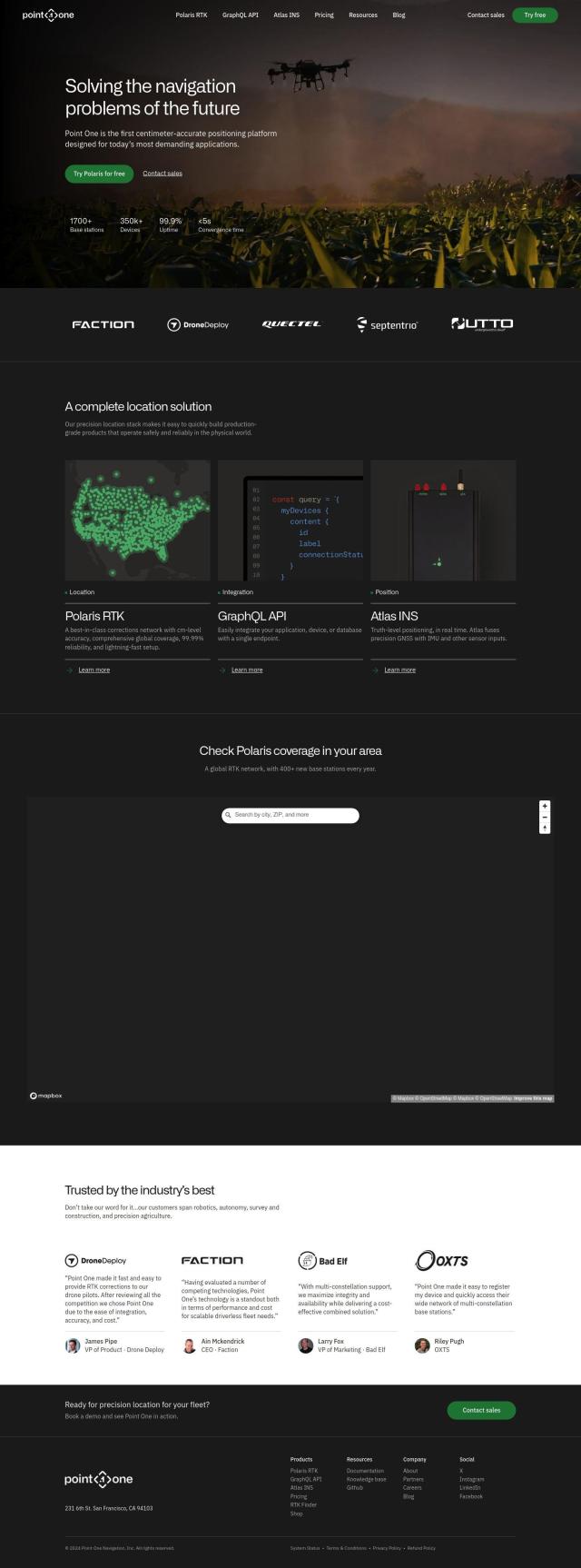
Point One screenshot thumbnail

Point One

If you need a platform that can deliver centimeter-level accuracy for navigation in difficult environments, Point One is a good option. It offers a precision location stack through its RTK corrections, which means you get the same level of accuracy anywhere in the world. The solution includes Polaris RTK, a corrections network with cm-level accuracy, and Atlas INS, which combines precision GNSS with inputs from an inertial measurement unit (IMU) and other sensors for truth-level positioning in real time. It supports a broad range of GNSS devices and has features like real-time observability and advanced device management.

Radar screenshot thumbnail

Radar

Another good option is Radar, an all-in-one location platform that's got a good reputation for hyper-accurate geofencing and mapping. Radar offers unlimited geofences and 5-meter accuracy, along with trip tracking and live ETAs. Its mapping abilities include geocoding APIs, search APIs and routing APIs, so it can be used for a variety of navigation needs. It also integrates with common tools and comes with enterprise-grade privacy and security.
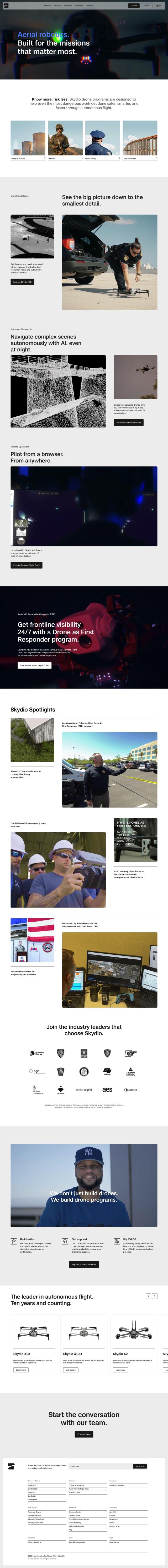
Skydio screenshot thumbnail

Skydio

If you need aerial navigation, Skydio has an interesting option with self-piloting drones that use AI and high-resolution cameras. The drones can fly autonomously and gather detailed information in difficult terrain, offering the best optics and remote operations. They're designed to be portable and rugged, so they're good for industries like Energy & Utilities and Defense.

Mapbox screenshot thumbnail

Mapbox

Last, Mapbox is a powerful location intelligence platform that offers customizable maps, advanced navigation and precise location search. It offers interactive maps with live updating data and advanced routing engines, and it has global datasets for boundaries, traffic and movement. Mapbox is used in many different applications, including connected navigation and data analysis, and offers a tiered pricing model with a free tier.

Additional AI Projects

MapmyIndia screenshot thumbnail

MapmyIndia

Seamlessly navigate and optimize last-mile operations with integrated navigation, route planning, and location intelligence solutions powered by India's best maps.

Polymath Robotics screenshot thumbnail

Polymath Robotics

Simplifies autonomous navigation for industrial off-highway vehicles, enabling easy automation without extensive robotics expertise.

FlyPix screenshot thumbnail

FlyPix

Detect, localize, track, and monitor objects across industries with advanced AI models, generating actionable, geo-referenced insights from complex imagery.

Mappedin screenshot thumbnail

Mappedin

Create interactive 3D indoor maps with AI-assisted tools, automated navigation, and content enrichment, and share them across various devices and formats.

Nearmap screenshot thumbnail

Nearmap

Transforms high-resolution aerial imagery into actionable insights with AI predictions, 3D modeling, and geospatial tools for informed business decisions.

EasyAR screenshot thumbnail

EasyAR

Enables developers to build augmented reality experiences with features like spatial mapping, motion tracking, and image recognition, with flexible toolchains for rapid development.

Wemap screenshot thumbnail

Wemap

Build interactive maps with augmented reality, indoor and outdoor navigation, and search capabilities for web and mobile applications.

CupixWorks screenshot thumbnail

CupixWorks

Automatically transforms 360-degree capture videos into as-built 3D spatial context for construction projects and facility management, improving project efficiency and accuracy.

Basemark screenshot thumbnail

Basemark

Enables immersive AR experiences in vehicles, anchoring overlays to real-world objects, avoiding motion sickness and occlusion of safety information.

Samsara screenshot thumbnail

Samsara

Samsara's fleet operations platform connects cameras, sensors, and workflows for faster, more confident decisions.

LocoNav screenshot thumbnail

LocoNav

AI-powered video technology analyzes traffic, identifies safety risks, and provides real-time alerts to mitigate risks and ensure a safer, more efficient fleet.

Teletrac Navman screenshot thumbnail

Teletrac Navman

Unify fleet operations with a single platform, tracking and optimizing vehicles, equipment, and drivers in real-time, improving safety, efficiency, and performance.

CarbonReach screenshot thumbnail

CarbonReach

Combines device, location, network, and behavior data to predict future risks, providing a comprehensive view of network activity for targeted security action.

Wikitude Augmented Reality screenshot thumbnail

Wikitude Augmented Reality

Build immersive AR experiences with image and object tracking, instant tracking, and geo AR, enabling interactive digital content in real-world environments.

Omnitracs screenshot thumbnail

Omnitracs

Combines fleet management expertise with AI and machine learning to provide actionable insights, optimize business performance, and improve driver satisfaction and safety.

Meteomatics screenshot thumbnail

Meteomatics

Access global high-resolution weather, ocean, environment, and climate data through a comprehensive API, including historical, real-time, and forecast data up to 2100.

Bluedot screenshot thumbnail

Bluedot

Empowers apps to send targeted messages and automate tasks with 20x accurate location detection, down to five meters, for seamless customer experiences.

LandingLens screenshot thumbnail

LandingLens

Unlock insights from unlabeled images, achieve accurate results, and deploy computer vision models flexibly and scalably across industries.

Airspace screenshot thumbnail

Airspace

Optimizes routing and dispatching for time-critical logistics, providing real-time visibility and automated delay detection to ensure fast and efficient shipping operations.

Scope AR screenshot thumbnail

Scope AR

Unify product lifecycle management with a single platform, enabling no-code content creation, real-time collaboration, and data-driven insights to boost productivity.