Question: I'm looking for a tool that provides accurate geospatial data to enhance my organization's security posture.

CARTO screenshot thumbnail

CARTO

CARTO is a cloud-native location intelligence platform that offers powerful spatial data analysis, visualization, and app development without the complexity of ETLs or data duplication. It integrates well with major cloud platforms and offers more than 12,000 geospatial datasets through its Data Observatory. CARTO's drag-and-drop interface and security features make it a good option for enterprise geospatial analytics.
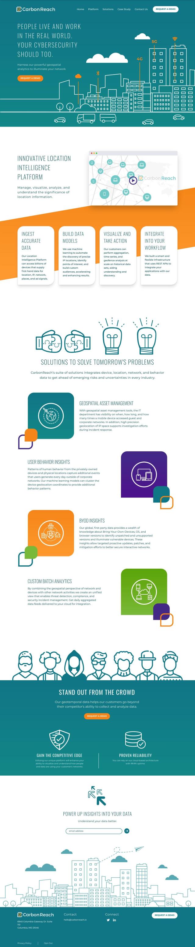
CarbonReach screenshot thumbnail

CarbonReach

CarbonReach is another strong option, built specifically for cybersecurity. It uses machine learning for sophisticated data analysis and offers good data ingestion, precise IP geolocation and scalable analytics. The platform is designed to help you manage and visualize location information to improve network security by combining device, location, network and behavior data. It offers a unified view of network activity to identify weaknesses and take targeted action.

Esri screenshot thumbnail

Esri

If you're looking for a more general-purpose GIS mapping and spatial analytics tool, check out Esri. Esri has a broad set of location intelligence and spatial analytics tools, including 3D visualization, predictive modeling and real-time decision-making. It serves a wide range of industries and use cases, so it's a good choice if you want to improve your organization's security and operations. With cloud and on-premise deployment options and a lot of training resources, Esri is a good option for geospatial data management.

Additional AI Projects

Radar screenshot thumbnail

Radar

Radar combines geofencing, geocoding, and mapping for accurate, cost-effective location-based experiences.

Nearmap screenshot thumbnail

Nearmap

Transforms high-resolution aerial imagery into actionable insights with AI predictions, 3D modeling, and geospatial tools for informed business decisions.

Mapbox screenshot thumbnail

Mapbox

Create customizable, interactive maps with live-updating data and advanced navigation features for web, mobile, automotive, and AR applications.

MapmyIndia screenshot thumbnail

MapmyIndia

Seamlessly navigate and optimize last-mile operations with integrated navigation, route planning, and location intelligence solutions powered by India's best maps.

EOSDA screenshot thumbnail

EOSDA

Utilizes satellite data and machine learning to provide actionable insights for sustainable agriculture and forestry, enabling data-driven decision making and reduced waste.

Spatial.ai screenshot thumbnail

Spatial.ai

Unlock deeper customer insights with behavioral segmentation tools, profiling social, mobile, and web behavior to inform targeted marketing and location strategies.

Censys screenshot thumbnail

Censys

Combines broadest internet intelligence with real-time context to identify and eliminate exposure, providing a detailed view of asset connections and threat details.

Flashpoint screenshot thumbnail

Flashpoint

Delivers timely, relevant, and actionable threat intelligence to empower organizations to lower risk and improve protection across multiple security teams.

Forescout screenshot thumbnail

Forescout

Automates cybersecurity across all connected assets, providing real-time visibility, risk management, and threat response through converged platform features.

Bluedot screenshot thumbnail

Bluedot

Empowers apps to send targeted messages and automate tasks with 20x accurate location detection, down to five meters, for seamless customer experiences.

Google Security Operations screenshot thumbnail

Google Security Operations

Combines threat intelligence and AI capabilities to detect, investigate, and respond to threats with intelligence, boosting productivity and efficiency.

Bitsight screenshot thumbnail

Bitsight

Instantly assess and reduce cyber risk across entire attack surfaces with comprehensive tools for external attack surface management, cybersecurity analytics, and more.

Vectra AI screenshot thumbnail

Vectra AI

Spots and responds to threats in real-time with AI-powered Attack Signal Intelligence, cutting alert noise by 80% and covering 90% of hybrid cloud MITRE ATT&CK techniques.

JupiterOne screenshot thumbnail

JupiterOne

JupiterOne provides complete enterprise visibility through continuous asset data collection and analysis.

Tenable screenshot thumbnail

Tenable

Unifies attack surface visibility, providing prioritized vulnerability management and remediation guidance to mitigate cyber threats and optimize business performance.

Panorays screenshot thumbnail

Panorays

Continuously monitors and adapts defenses for each unique third-party relationship, providing real-time risk scores and actionable threat alerts to defend against cyber threats.

Rubrik screenshot thumbnail

Rubrik

Automates data protection across enterprise, cloud, and SaaS applications, providing rapid recovery and threat detection with machine learning-powered analytics.

Splunk screenshot thumbnail

Splunk

Unify security and observability with AI-driven insights to accelerate digital transformation and resilience.

Varonis screenshot thumbnail

Varonis

Continuously discovers and classifies critical data, removes exposures, and stops threats in real-time using AI-powered automation.

Lookout screenshot thumbnail

Lookout

Identifies and responds to breaches in real-time with AI-driven threat intelligence, providing end-to-end security and visibility across mobile, cloud, and web environments.

RiskRecon screenshot thumbnail

RiskRecon

Provides real-time visibility into digital environments, enabling companies to identify and prioritize cyber risks across third-party partners, supply chains, and internal systems.